


| Other Sellers | Prices | ShippingCost | |
|---|---|---|---|
| amazon.com | US $2.9 | US $0.9 | buy in amazon |
| us.shein.com | US $0.9 | US $1.9 | buy in shein |
Bestseller
1877 HENRIETTA Township- MONROE County - NEW YORK Lithograph Print (20x12)
ebay.com
selsa84100.0% positive rating
US$44.00
Antiques
Maps, Atlases & Globes
North America Maps
shippingCost free
most popular

1900 Atlas RENVILLE County Minnesota Plat Book Maps History Photos Olivia Morton
$295.00

1848 MEXICO - REPUBLIC OF TEXAS Map ORIGINAL Jeremiah Greenleaf (12X10)
$248.00

1890 Cape Cod & Martha’s Vineyard Old Colony Line Antique Map
$240.00

Pennsylvania 1796 Harris Doolittle rare American hand colored early state map
$210.00
$350.00
Bestseller
40% OFF

1879 VIEW of NANTASKET Beach - HULL - MASSACHUSETTS - Map ORIGINAL (25X15)
$189.00

1914 ALAMEDA COUNTY - CALIFORNIA - Promotional Map ORIGINAL San Lorenzo (32x18)
$168.00

1834 Carey Map SW United States Mexico Texas California New Albion Guatemala
$150.00

VINTAGE RAND MCNALLY LARGE FORMAT PULL DOWN SCHOOL MAP MICHIGAN 1984 approx57x70
$149.99

1871 TERRITORY DAKOTA - NEBRASKA - MINNESOTA Map ORIGINAL (16X14)
$130.88

1855 Charles Savage Map United States Oregon Nebraska New Mexico Utah Territory
$125.00

1844 MEYER MAP NEUESTE KARTE VON LOWER CANADA QUEBEC EASTERN TOWNSHIP
$120.00

1861 Johnson’s New Illustrated (Steel Plate) Family Atlas. MISSING PLATES.
$99.95

VINTAGE ORIGINAL GRAND TETON NATIONAL PARK WYOMING USGS TOPOGRAPHICAL MAP 1945
$99.95

1943 RAILROADS of COLORADO Map ORIGINAL (37x23) KALMBACH - WALL MAP
$80.00

Central America Coast Rica Nicaragua Honduras 1867 A.J. Johnson Scarce Issue map
$75.00

Florida great early state map 1870 Johnson large hand colored map w/Keys inset
$57.00
$95.00
Bestseller
40% OFF

Boston city plan Massachusetts 1870 Johnson large hand colored map
$57.00
$95.00
Bestseller
40% OFF

Antique 1895 US Geological Atlas Pikeville Tennessee Folio Maps
$45.00

1864 MINNESOTA - DAKOTA TERRITORY Map ORIGINAL Johnson (15x12) EARLY FORTS
$42.00
1885 MAP- INDIAN TERRITORY - OKLAHOMA ORIGINAL (12X9) Cherokee Outlet CREEK
$40.88

1864 MISSOURI - KANSAS Map ORIGINAL Johnson (22x16) LARGE CIVIL WAR - RAILROADS
$40.88

1929 SOUTHAMPTON - FLANDERS - LONG ISLAND Map ORIGINAL Suffolk County (22x13)
$40.88

1929 LONG ISLAND Map ORIGINAL Suffolk County (24x16) NEW YORK Bay Shore Islip
$40.00

1871 ILLINOIS Counties Map PUTNAM PEORIA MARSHALL WOODFORD TAZEWELL (16X13)
$38.88

North America 1652 Vintage Style Early United States Map - 36x42
$36.95

1871 ILLINOIS Counties Map JO DAVIESS - ROCK ISLAND - CARROLL - STEPHENSON
$36.88

1874 GRANGER - OHIO Township PLAT Map ORIGINAL (13.5x13) MEDINA COUNTY
$36.00

ORIGINAL HAWAII 1930'S MAP RUTH TAYLOR WHITE
$35.00

Vintage Sectional Aeronautical Chart-23.5 X 46-1965-Mobile Pensacola Gulf
$29.99

1862 Bacons Military Map of America Civil War Wall Map Poster - 24x36
$25.95

1862 Military & Railroad Map US Civil War Era - 24x32
$24.95

St. Simons Sound, Brunswick Harbor & Turtle River, GA - 2020 Nautical Chart
$24.95

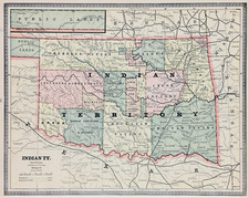
1890s “Map of the Indian and Oklahoma Territories” Vintage State Map - 24x32
$24.95

Fair Haven, NY - 1943 Topographic Map | Vintage USGS Print | Historic NY Map
$24.95

1830s Historic Map of The Republic of Texas by Stephen F Austin - 24x30
$23.95

1771 Early American 13 Colonies - East Coast Map - 24x28
$23.95

Early 1900's Western Land Securities Co Ownership Map St. Paul Minnesota
$19.99

CONNECTICUT Map Branford Electric Railway Shore Line Trolley Line System
$19.96
$24.95
Bestseller
20% OFF

Lumpkin, Georgia 1955 Photorevised 1984 Original Vintage USGS Topo Map
$19.95

1732 Carolina Historic Old American Map - 20x28
$17.95
North America 1771 Colonial Map - 13 Colonies - 20x24
$16.95

1750s Detailed Map of New Spain and the Spanish Colonies - 20x24
$16.95

1680s Early Map of North America - New Mexico - English Empire - 20x24
$16.95

Map of Crawford Notch, NH (White Mountain National Forest) 1946 Edition
$15.00

1860s “Township Map of the State of Ohio” Vintage Style US Map - 16x20
$13.95

1869 Leavenworth Kansas Vintage Old Panoramic City Map - 18x24
$13.95
Carolina 1732 Interesting Old Historic Map - 18x24
$13.95

1930s Cape Cod Massachusetts Historic Early Map - 16x24
$13.95


